
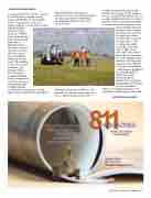
Page 19 - Arkansas 811
P. 19
CONTINUED FROM PAGE 15
recommendations for effective practices to facilitate data ex-change among project stakeholders. It is essentially
a “how to specify the creation of a utility certified record drawing” so that individual utility
owners’ facilities
and project utilities
have standardization
rather than literally
hundreds of
differing formats
and accuracies and
amounts of details
about the new or
relocated utilities
within a project’s
limits. The guideline
is critical to capture,
document, and
exchange utility
data for project
scoping, planning,
design, construction,
operation, and long-
term management
of utility systems
as well as the management of public right-of-way and properties throughout
which utility infra-structure are installed. It is also beneficial to facilitate the interaction among stakeholders
for managing utility and other civil infrastructure.
an efficient useful investigation that provides data in time for the designers to use it effectively. The first practice is to collect utility information as early as possible in project development. Early decisions such as line and grade, deep
versus shallow drain-age systems, siting of bridge foundations or structure footings, right-of-way requirements, and more are expensive to redo
or change if a utility requiring a long lead
time or high cost for relocation is discovered late in the process. Since it is well established that utility records are many times incorrect, difficult to obtain, or unavailable, comprehensive geophysics are typically applied within the project footprint, and the
results of the geophysics synthesized with existing records and visual
evidence. Communicating these data to individual task designers along with
CONTINUED ON PAGE 18
 Although each project is different and warrants its own procedures, there are some common practices that lead to
 2023, Issue 2 Arkansas 811 Magazine • 17
